Environment Canada has issued a Snow Squall Watch for Toronto and parts of the GTA ahead of a second round of snow.
Posted Feb 18, 2021, 05:32AM EST
Environment Canada has issued a Snow Squall Watch for Toronto and parts of the GTA ahead of a second round of snow.
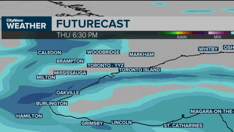
Toronto, Peel, and Halton regions are under the watch, which is calling for snow squalls to develop over the west end of Lake Ontario Thursday morning and last through the night.
“These snow squalls have the potential to produce 15 cm in 12 hours,” said the national weather service. “Current indications suggest that the snow squalls could affect shoreline areas from Toronto Island to Burlington as well as areas inland.”
“Motorists should be prepared for possible winter driving conditions, especially along the QEW and portions of highway 403 and 407 on Thursday.”
The snow will start to fall in the morning but pick up in intensity during the afternoon and evening with lake effect snow hitting the west end of the GTA the hardest. Depending where you are, between 2 to 25 cm could fall by Friday morning. @adamstiles pic.twitter.com/1jL1nA5DwI
— CityNews Toronto (@CityNewsTO) February 18, 2021
Most of the Golden Horseshoe is expected to see anywhere from 5-to-10 cm, but localized totals of 10-to-20 cm are possible between Burlington and Mississauga.
The snow should taper off by Friday morning.
This comes on the heels of a winter storm that hit the GTA and much of Southern Ontario Monday evening into Tuesday morning.
